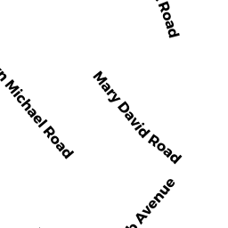
9 KATHARYN MICHAEL RD
Owner Information
EVANS MARY I
9 KATHARYN MICHAEL RD
YARMOUTH PORT, MA 02675


Property Details
9 KATHARYN MICHAEL RD is classified as a Single Family Residential (Cape cod).
The primary structure on this property was built in 2000. There are 3,800ft2 of built area within this property. There is 2,252ft2 of residential/living space within this property.
9 KATHARYN MICHAEL RD is valued at $472,900. The land is valued at $118,100 and the structures are valued at $352,500. There is an additional valuation of $2,300 on this property.
The most recent deed for 9 KATHARYN MICHAEL RD is recorded at the local registrar in Book 27073, Page 102. 9 KATHARYN MICHAEL RD was last sold on Friday, January 25, 2013 for $100.
Assessment data from fiscal year 2022.
Flood Data
According to the FEMA National Flood Hazard Layer, this property does not appear to be in a flood zone. It may also be in an area not yet reviewed. Nonetheless, confirm this information prior to taking any action.
To view the flood hazards around this property, create a FEMA "Firmette" Map of the area around 9 KATHARYN MICHAEL RD.
Broadband Internet Providers
| Provider | Type | Bandwidth (mbps) | |
|---|---|---|---|
| Viasat Inc | Satellite | 35 | 3 |
| VSAT Systems, LLC. | Satellite | 2 | 1 |
| HughesNet | Satellite | 25 | 3 |
| GCI Communication Corp. | Satellite | 0 | 0 |
| T-Mobile | Fixed Wireless | 25 | 3 |
| Comcast | Cable | 1000 | 35 |
| Verizon New England Inc. | DSL | 5 | 0 |
Broadband service provider data from December 2020.
Adjacent Properties
- 38 WEIR RD
Single Family Residential owned by ERENIUS RICHARD - 42 WEIR RD
Single Family Residential owned by CRONEN DAVID J - 17 KATHARYN MICHAEL RD
Single Family Residential owned by JOURNET ERIK - 5 KATHARYN MICHAEL RD
CONDO NL MDL-0 owned by WILMINGTON SAVINGS FUND SOCIETY - 7 KATHARYN MICHAEL RD
CONDO NL MDL-0 owned by LOPES ALBERT L